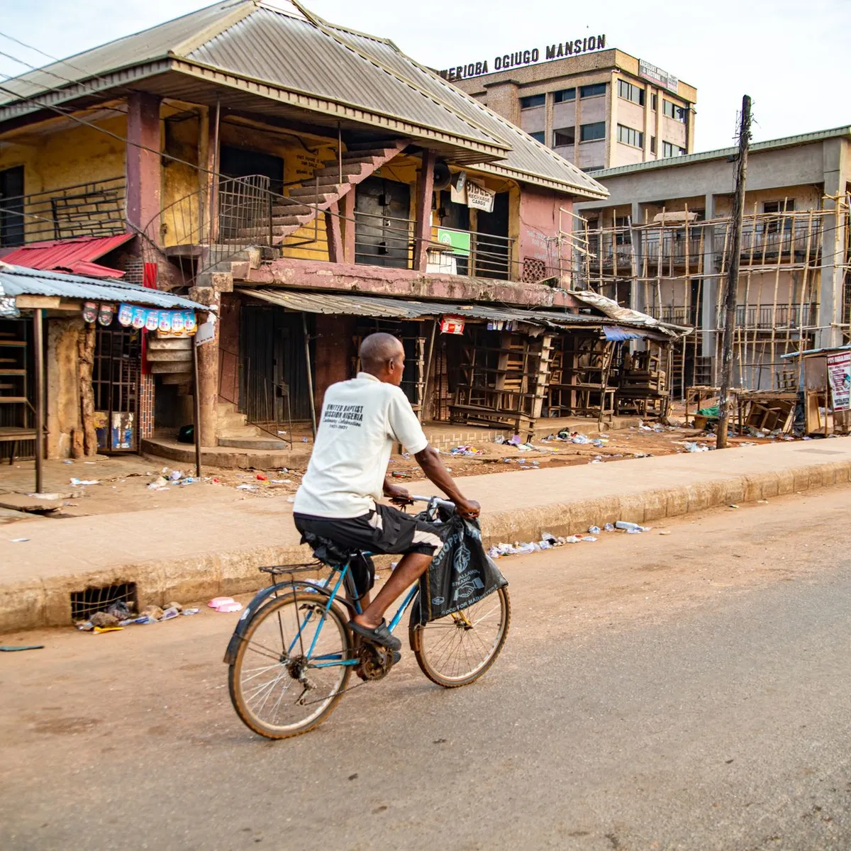
 Photo: David Iloba / Pexels
Mbandaka
Mbandaka accessibility for wheelchair users
Compare Mbandaka by accessibility, transport, terrain, healthcare, cost, weather, laws, reviews, and community notes.
Mbandaka accessibility scores
Compare Mbandaka by accessibility, transport, terrain, healthcare, cost, weather, and laws. General stats use public data and models. Community rows reflect member reviews and votes.
General stats
National benchmarks and estimates — your experience in this city may differ.
Community
Starts from our estimate — thumbs up nudge toward Excellent, down toward Poor. Reviews use 1–5 stars.
These figures combine public statistics, models, and live weather where available. Every city is different — treat this as a guide, and share what you know in the Reviews & Corrections tab.
Profile last updated 7/1/2026.
Mbandaka wheelchair accessibility guide
Research Mbandaka for wheelchair users and caregivers: getting around, terrain, healthcare, costs, climate, accessible things to do, and practical caveats before booking.
Last updated 7/1/2026At a glance
Mbandaka is the capital of Équateur Province, near the confluence of the Congo and Ruki rivers and only a few kilometers from the equator. It is more recognizable than many remaining empty RollVenture rows because it has documented river geography, an airport, historic mission sites, and the Eala Botanical Garden nearby. For wheelchair users, the biggest advantage is flat terrain; the biggest risks are poor pavement data, limited verified step-free transport, heat, rain, and the need to confirm every site locally. Budget from ~$2,380/mo, with housing from ~$1,216/mo.
Getting around
Mbandaka is linked by air and river, but city travel should be planned as private, assisted, door-to-door movement. Wikipedia notes river barge connections toward Kinshasa and Boende; those should not be treated as accessible unless an operator confirms boarding, toilets, cabin access, and help with transfers. Around town, arrange a known driver, check road surface after rain, and avoid relying on spontaneous accessible transport.
Terrain & mobility
The terrain profile is comparatively favorable: OpenTopoData marks it mostly flat, with a sampled max grade around 0.7% and elevation range near 49 m. That does not mean easy rolling. OSM pavement data is medium-confidence, with many untagged, unpaved, ground, and asphalt surfaces. Expect flat but rough routes, mud, drainage edges, and inconsistent curb cuts.
Healthcare & care
OSM healthcare leads include Hôpital général de référence Wangata, CHU, CS Gini, CS Croix Rouge, and CSR Ngashi. These are useful starting points because several are close to the city centre, but verify entrance access, ambulance response, medication availability, and whether staff can support transfers. Bring a backup plan for complex care and pressure-relief supplies.
Costs & housing
Costs are estimated from ~$2,380/mo, with housing from ~$1,216/mo. Pay more attention to physical setup than listing quality: hard-surface approach, no stairs, wide doorways, roll-in or low-threshold washing, generator reliability, and shade. In a humid river city, also check mold, ventilation, mosquito control, and whether roads to the property flood.
Climate & comfort
The equatorial river setting means heat, humidity, and rain are central comfort issues. Plan early-day outings, shaded waits, and generous transfer time. Batteries, cushions, and medication should be protected from moisture, and routes near the river or wetland edge should be checked immediately before travel.
Accessible things to do
Eala Botanical Garden— a documented main sight near Mbandaka; contact locally about paths, vehicle access, and whether a short supported visit is realistic.
Bamanya Catholic mission and research centre— a documented historical stop; verify road condition and step-free access before committing.
Congo and Ruki riverfront orientation— the confluence geography is central to the city; use vehicle-based viewing if bank paths are muddy or stepped.
Mbandaka commercial centre— useful for errands and local life; choose short blocks and quieter times.
Community & language
French is the administrative language, with Lingala and Mongo-area languages common locally. A French-speaking helper will make housing, transport, and clinic verification much easier.
Would we recommend it?
Maybe, with support. Mbandaka's flatness and identifiable sights are positives, but access remains under-verified. It is best for travelers with a local host, a private driver, and flexible expectations.
These figures combine public statistics, models, and live weather where available. Every city is different — treat this as a guide, and share what you know in the Reviews & Corrections tab.
Profile last updated 7/1/2026.