 Photo: Miguel Cuenca / Pexels
Valparaíso
Valparaíso accessibility for wheelchair users
Compare Valparaíso by accessibility, transport, terrain, healthcare, cost, weather, laws, reviews, and community notes.
Valparaíso accessibility scores
Compare Valparaíso by accessibility, transport, terrain, healthcare, cost, weather, and laws. General stats use public data and models. Community rows reflect member reviews and votes.
General stats
National benchmarks and estimates — your experience in this city may differ.
Community
Starts from our estimate — thumbs up nudge toward Excellent, down toward Poor. Reviews use 1–5 stars.
These figures combine public statistics, models, and live weather where available. Every city is different — treat this as a guide, and share what you know in the Reviews & Corrections tab.
Profile last updated 6/30/2026.
Valparaíso wheelchair accessibility guide
Research Valparaíso for wheelchair users and caregivers: getting around, terrain, healthcare, costs, climate, accessible things to do, and practical caveats before booking.
Last updated 6/30/2026At a glance
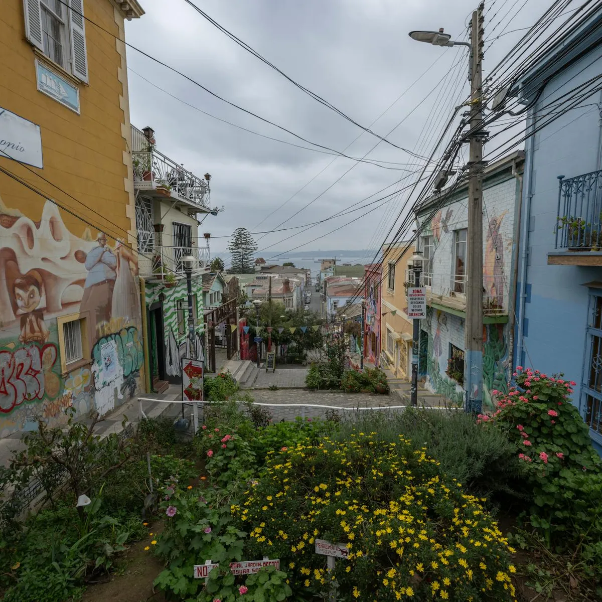
Valparaíso is visually extraordinary but demanding for wheelchair users. The city is famous for steep hills, port-side flats, heritage streets, murals, and funicular-style ascensores; those same features create major access friction. It can be rewarding with a companion, private transport, and a carefully chosen flat base, but it is not a simple independent mobility destination.
Getting around
Metro Valparaíso connects the wider coastal corridor, and local buses, colectivos, taxis, and ride-hail fill in the hills. For wheelchair users, the key is not just the line map but lift status, station entrance, pavement, and the last steep block. Use the flatter port/El Plan area as an anchor and pre-arrange vehicles for hill districts rather than assuming you can roll between cerros.
Terrain & mobility
The DB terrain profile marks Valparaíso as very hilly, with max sampled grades around 8.6% and a large elevation range. The pavement profile is strong by surface tagging, with high-confidence concrete/asphalt/paved samples, but slope often matters more than surface. Manual-chair users should treat many hillside streets as assistance-only; power-chair users need battery margin and safe descent planning.
Healthcare & care
The DB healthcare leads include CESFAM Marcelo Mena, Centro Médico y Dental RedSalud, CESFAM Puertas Negras, and other clinic entries from OpenStreetMap. For emergency planning, identify the current hospital route before arrival and confirm whether your accommodation can call local assistance. Chile has stronger disability-rights law than many regional peers, but practical access still varies by building and hill district.
Costs & housing
The database estimate is **from ~$2,379/mo**, with housing around **$1,001/mo**. In Valparaíso, location is accessibility: a cheaper hillside room can be unusable if the entrance requires stairs or steep cobbles. Prioritize level entry, lift access, bathroom photos, and a street where vehicles can stop safely.
Climate & comfort
The coastal climate is milder than inland Chile, but wind, fog, rain, and damp pavement can make slopes more tiring. Sun exposure on open viewpoints is also real. Carry layers and plan indoor breaks near the port or museum areas.
Accessible things to do
El Plan / port-side historic district— The flatter lower-city grid is the best starting area for murals, cafés, and orientation; still watch kerbs and uneven heritage paving.
Plaza Sotomayor area— A major civic square near the port; use it as a flatter meeting and drop-off point rather than a guarantee that surrounding hills are rollable.
Museo de Historia Natural de Valparaíso— A central museum to verify directly for current lift, ramp, and toilet access before visiting.
Cerro Alegre / Cerro Concepción viewpoints— Important heritage neighbourhoods, but they need vehicle-assisted routing and careful checks because slopes, stairs, and narrow pavements are common.
Community & language
Spanish is essential for detailed access checks. Ask accommodation to call museums, drivers, and clinics, and keep written Spanish descriptions of chair dimensions and transfer needs.
Would we recommend it?
Yes for adventurous travellers with assistance and a strong reason to experience Valparaíso. No for a first wheelchair trip or anyone needing predictable step-free routes every day.
These figures combine public statistics, models, and live weather where available. Every city is different — treat this as a guide, and share what you know in the Reviews & Corrections tab.
Profile last updated 6/30/2026.