 Photo: Juan Diavanera / Pexels
Facatativá
Facatativá accessibility for wheelchair users
Compare Facatativá by accessibility, transport, terrain, healthcare, cost, weather, laws, reviews, and community notes.
Facatativá accessibility scores
Compare Facatativá by accessibility, transport, terrain, healthcare, cost, weather, and laws. General stats use public data and models. Community rows reflect member reviews and votes.
General stats
National benchmarks and estimates — your experience in this city may differ.
Community
Starts from our estimate — thumbs up nudge toward Excellent, down toward Poor. Reviews use 1–5 stars.
These figures combine public statistics, models, and live weather where available. Every city is different — treat this as a guide, and share what you know in the Reviews & Corrections tab.
Profile last updated 7/1/2026.
Facatativá wheelchair accessibility guide
Research Facatativá for wheelchair users and caregivers: getting around, terrain, healthcare, costs, climate, accessible things to do, and practical caveats before booking.
Last updated 7/1/2026At a glance
Facatativá is a highland city west of Bogotá with real cultural interest, especially the Piedras del Tunjo archaeological park and the historic centre. For wheelchair users, the question is not whether there is anything worth seeing; it is whether the altitude, hills, and older street fabric fit your body and equipment. The live row shows a very hilly terrain profile, high elevation around 2,333 m, medium-confidence pavement data, and moderate ramp/transport scores. It can work for a short stay or Bogotá-region day trip, but only with careful routing and realistic expectations.
Getting around
Private car or arranged taxi is the safest plan. Intermunicipal buses from Bogotá may be possible for some travelers but should not be treated as accessible by default. Within town, keep distances short and ask drivers for door-to-door drop-offs near the plaza, clinic, or park entrance. High altitude can amplify fatigue, so schedule recovery time after transfers.
Terrain & mobility
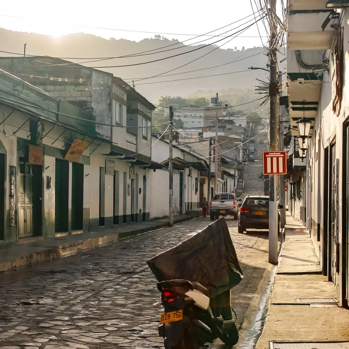
This is the biggest caution. The sampled terrain profile labels the area very hilly, with steep grades around the city and a large elevation range. The central grid has more usable short segments, but side streets and approaches to viewpoints can be difficult. Pavement data shows asphalt, paving stones, and pebblestone among dominant surfaces. Manual-chair users should assume assistance may be needed on slopes and rough blocks.
Healthcare & care
The DB healthcare profile lists several nearby OpenStreetMap leads, including Salud Total-Virrey Solis Facatativá, Davita Facatativá, Clinica Santa Ana, Famisanar-Cafam, and Clinica Medilaser. These are useful proximity leads but not verified accessibility guarantees. For complex care, Bogotá is the deeper medical market; build transfer time into appointments.
Costs & housing
The row estimates living costs from ~$1,806/mo, with housing around $627/mo. Accessible apartments may be limited in older buildings. Prioritize newer construction with lifts, flat garage entry, and bathroom videos. Because of the altitude and cool climate, check heating, hot water, and whether the route from parking to unit is covered.
Climate & comfort
The climate is cool and changeable, with strong sun at altitude and frequent rain. Wet paving stones and steep kerbs are a fall risk. Bring layers, rain protection for cushions and electronics, and allow time to acclimatize.
Accessible things to do
Parque Arqueológico Piedras del Tunjo— The main cultural anchor. Paths and rock-art viewing areas may be uneven, so confirm current accessible route options and use a companion.
Cathedral of Facatativá— A central landmark on the main square. Verify entrance steps and side access before visiting.
Parque Principal / Plaza Simón Bolívar— The most practical town-centre outing, with short distances to cafés and services. Scout kerb cuts around the square.
Facatativá rail and historic-centre area— Good for a car-assisted look at local heritage, but surfaces vary and not every block is chair-friendly.
Community & language
Spanish is essential for transport, clinics, and housing checks. People are generally helpful, but accessibility concepts may need concrete examples: “no escalón,” door width, ramp slope, and bathroom turn space.
Would we recommend it?
Maybe, for travelers already visiting the Bogotá region and comfortable with altitude, slopes, and assisted transfers. It is interesting but not easy.
These figures combine public statistics, models, and live weather where available. Every city is different — treat this as a guide, and share what you know in the Reviews & Corrections tab.
Profile last updated 7/1/2026.
Reviews & corrections
Share your experience or suggest a data correction. Both appear publicly; admin updates official city scores and costs separately.
Log in to write a review or suggest a correction.
No reviews or corrections yet.